
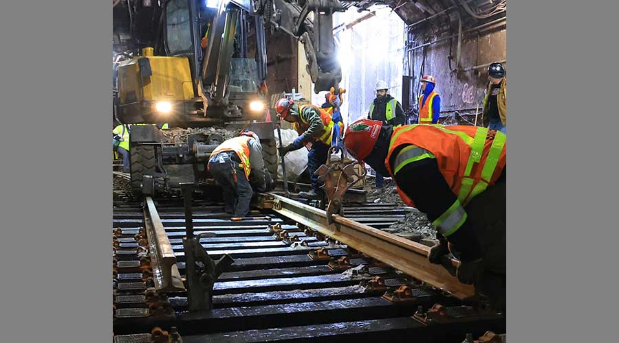
 2025 MOW Spending Report: Passenger-rail programs
 Gardner steps down as Amtrak CEO
 Guest comment: Oliver Wyman’s David Hunt
 Women of Influence in Rail eBook
Stay updated on news, articles and information for the rail industry
April 2016
Rail News: Rail Industry Trends
Perspective: Managing LiDAR Rail Infrastructure Big Data
By Steve Schlickman
LiDAR 3D scanning, a surveying technology that measures distance by illuminating a target with laser light, and in particular mobile LiDAR has become an important tool for transportation infrastructure project planning, project development, construction, operations, maintenance, safety, research and asset management. The challenge is that LiDAR scanning creates such a massive amount of data that scanning companies have been challenged in presenting the information in a manageable format to their clients.
 Georeferenced data can be processed, hosted and located on a Google Map.
(Click to view larger.)
Photo from demo on www.ugridd.com
Two companies engaged in LiDAR scanning of transit-rail infrastructure have addressed this challenge by utilizing the uGRIDD.com data management service, a system that enables easy to show, share, host and find infrastructure big data.
Five years ago, Zhong Chen, the president of Chicago-based Dynasty Group Inc., had the vision to create a service that built on the old saying that "everything is somewhere." He utilized the Google Maps AIP platform and called the system uGRIDD, a service that both technical and non-technical individuals can use to organize and provide easy access to their infrastructure data. Data sharing is done over standard internet browsers in a secured environment; no other additional software is necessary.
Easy data sharing
To support an individual infrastructure project, georeferenced data can be processed, hosted and located on a Google Map, using uGRIDD’s uSHOW product. Any team member of a project can use uSHOW to publish a project data web page within a few minutes, share it with the rest of the project team through a unique URL, and expand it into multiple webpages organized through uGRIDD’s uKAN product.
With respect to LiDAR data collection efforts, uGRIDD offers a cloud-based data management solution including a location-based query tool called uFIND. Users can note a location of interest (LOI) on the Google map then select the interested layers of data. The found data can also be filtered with additional query conditions. uFIND is a subscription service.
 uGRIDD’s TruView2map tool overlays multiple Leica TruViews on an interactive Map.
(Click to view larger.)
Photo from demo on www.ugridd.com
Without subscription, you could use this function to find data hosted by uGRIDD and data uploaded by other users for public finding and viewing. uFIND can also be used to locate users, user groups, organizations and user generated URLs, as long as these special data element are set for public visibility.
The LOI can be a point, a line string or a shape. To work with customers’ existing data, uGRIDD offers the interface and processing service, uSHARE, to bring data layers to the uGRIDD platform so that users can take advantage of powerful uFIND functions.
Each completed uFIND session can be saved as a unique URL so that the search can be repeated with updated data sets using the same set of query parameters. The uGRIDD Cloud Data Management Solution can work with any analytical tools.
Rail industry examples
Dynasty utilized uGRIDD to host the LiDAR data it collected for the Chicago Transit Authority’s rail system. uGRIDD handles the back-end processing, which made it easy to organize, share, visualize and interact with terabytes of data. Dynasty President Chen says, "By creating and hosting mobile point cloud vantage points on uGRIDD, we were able to fully access the point cloud via the project portal for feature extractions. These are all efficiency realized, which then became a savings for the CTA."
Maser Consulting P.A., headquartered in Red Bank, N.J., is utilizing uGRIDD on projects for the Southeastern Pennsylvania Transportation Authority and for other large transit-rail systems. They had found the management of LiDAR and other geospatial data a challenge and did not have a good approach to store and view the data.
After discovering the uGRIDD service and utilizing it, Geospatial Director Paul DiGiacobbe said, "uGRIDD gives us the ability to get the data in a very clearly consumable format without having any special software, just a web connection. It is a silver bullet data delivery system that is very simple for our clients to use."
DiGiacobbe has found that client companies also can set up their own cloud-based data structures for hosting the data, and uGRIDD can be adaptable to it. He views that as a big advantage.
Stephen E. Schlickman is part-time VP of Public Affairs at uGRIDD. Schlickman was previously with the Urban Transportation Center at the University of Illinois Chicago and the Regional Transportation Authority of Northeastern Illinois (RTA). uGRIDD is the brainchild of Chicago-based Dynasty Group Inc., a professional engineering and land surveying firm that specializes in design engineering, construction engineering, surveying, nondestructive testing, and GIS support services.

Keywords
Browse articles on uGRIDD LiDAR 3D scanning mobile LiDAR Dynasty Group Inc. Zhong Chen Internet of Things IoTContact Progressive Railroading editorial staff.